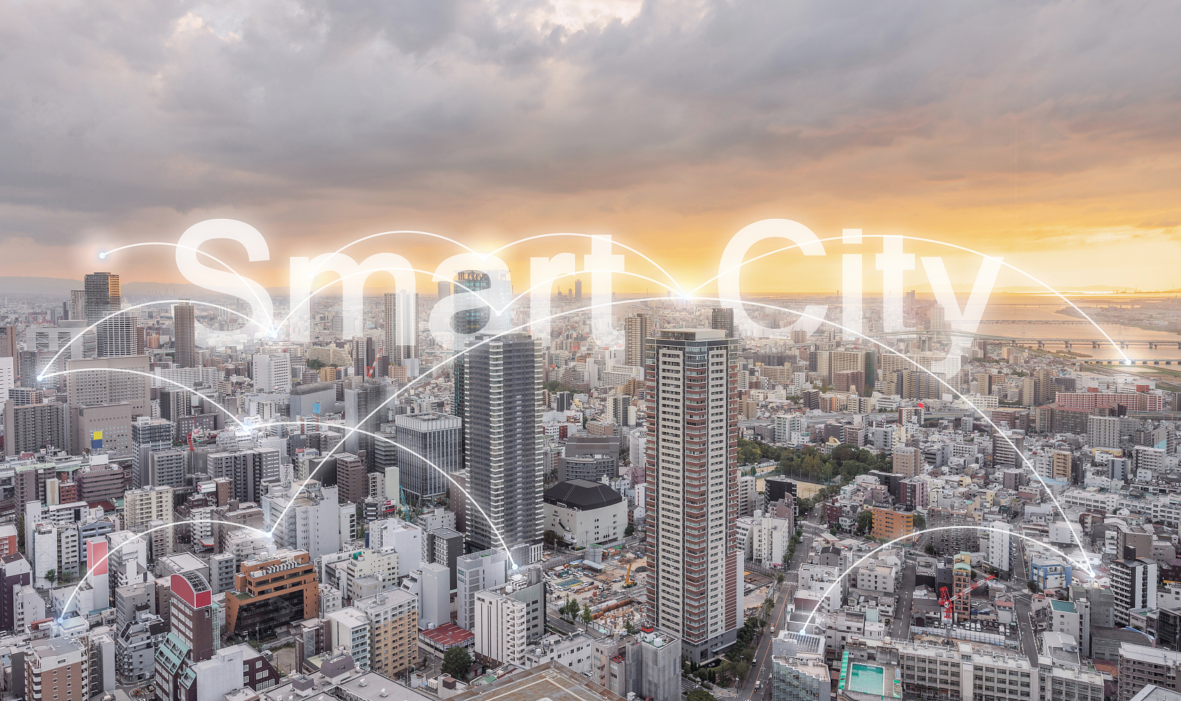
As urban populations grow quickly and environmental challenges increase, cities worldwide are using advanced weather monitoring systems. These systems help support sustainable development and make infrastructure more resilient.
Weather monitoring for urban planning is now a vital tool. It helps city planners, engineers, and policymakers make smart choices. They can improve infrastructure, prepare for disasters, manage resources, and adapt to climate changes.
Urban areas are highly susceptible to various weather-related challenges, including extreme heat, heavy rainfall, flooding, and strong winds. These events can cause significant damage to infrastructure, disrupt transportation networks, and pose risks to public health and safety.
As cities grow, good weather monitoring is important. It helps identify risks and plan for extreme weather events. This ensures urban areas can adapt to changing climate conditions.Key areas where weather monitoring contributes to urban planning include:
Flood Prevention and Management
Cities with poor drainage systems are particularly vulnerable to flooding, especially during periods of heavy rainfall. Urban planners can install weather monitoring systems with rainfall sensors and water level gauges. This helps them collect real-time data on rain and water levels in important areas.
This data helps predict flood events. It also aids in designing flood protection measures like levees and drainage systems. Additionally, it supports preparing emergency responses. Early flood warnings, based on weather data, can save lives, reduce property damage, and minimize disruption.
Heat Island Mitigation
Urban heat islands (UHIs) are parts of a city that are warmer than nearby rural areas. This happens because of human activities and crowded buildings. Cities with high concentrations of concrete, asphalt, and buildings tend to absorb and retain more heat. This can lead to increased energy consumption, poor air quality, and health risks such as heatstroke.
Temperature sensors placed throughout the city can monitor heat patterns, helping urban planners identify UHI hotspots. This data helps planners use strategies like green roofs, urban forests, reflective materials, and better landscaping. These strategies can reduce urban heat and make residents more comfortable.
Energy Efficiency and Resource Management
Accurate weather data is vital for optimizing energy usage in cities. Cities can save energy by linking weather monitoring systems with building management systems (BMS). This allows them to adjust energy use based on current weather conditions.
For example, solar radiation sensors give data to improve solar panel use. Wind speed sensors help operate wind turbines in cities. Weather data can help manage water resources better. This ensures that irrigation systems are used only when needed. It also keeps reservoirs at the right levels.
Transportation and Traffic Management
Weather conditions such as heavy rain, snow, or fog can disrupt transportation systems and contribute to traffic accidents. Real-time weather data can help manage traffic better. It can also improve public transportation schedules and issue safety warnings to commuters.
Road surface temperature sensors can give early warnings about icy conditions. This helps cities start de-icing operations before problems arise. By integrating weather data into traffic management systems, cities can reduce congestion, improve safety, and minimize travel disruptions.
Disaster Preparedness and Climate Resilience
Extreme weather events are happening more often. This includes hurricanes, storms, and wildfires. They are also becoming stronger. This is due to climate change. Cities need to be prepared for these events to reduce their impact.
Wind speed sensors, barometers, and humidity sensors give important information about weather systems. This information can help predict extreme events.
Urban planners can use this data to develop disaster preparedness plans, construct more resilient infrastructure, and create evacuation routes. Understanding weather patterns also enables cities to incorporate climate adaptation strategies, ensuring that urban infrastructure is future-proofed against climate change.
Urban areas often face poor air quality because of vehicle emissions, industrial activities, and construction. Weather greatly affects air quality. Temperature, wind speed, and humidity influence how pollutants spread and concentrate.
Weather monitoring systems have air quality sensors and weather tools. They can track how weather affects pollution levels. This helps cities act to improve air quality.
For example, if high temperatures and low winds are expected, cities can issue air quality alerts. They can also limit traffic or encourage public transportation use.
Improved Decision-Making
Urban planners can use real-time weather data to make smart decisions. This helps them use resources better and improve the safety, sustainability, and strength of cities. This reduces uncertainty in planning and allows for better long-term infrastructure strategies.
Enhanced Sustainability
Weather monitoring helps cities reduce their environmental impact by enabling more efficient energy and water management. With accurate weather data, cities can implement green initiatives more effectively, such as optimizing the use of renewable energy sources and reducing emissions.
Better Public Health and Safety
Accurate weather data is critical for protecting public health during extreme weather events. By forecasting temperature spikes, air pollution, and storm events, cities can issue health advisories, implement safety protocols, and ensure vulnerable populations are protected.
Cost Savings
By anticipating weather-related risks and making informed decisions, cities can prevent expensive damage to infrastructure and reduce the costs of emergency responses. Proper planning also leads to cost-effective investments in climate resilience measures, ensuring that urban infrastructure can withstand extreme weather events.
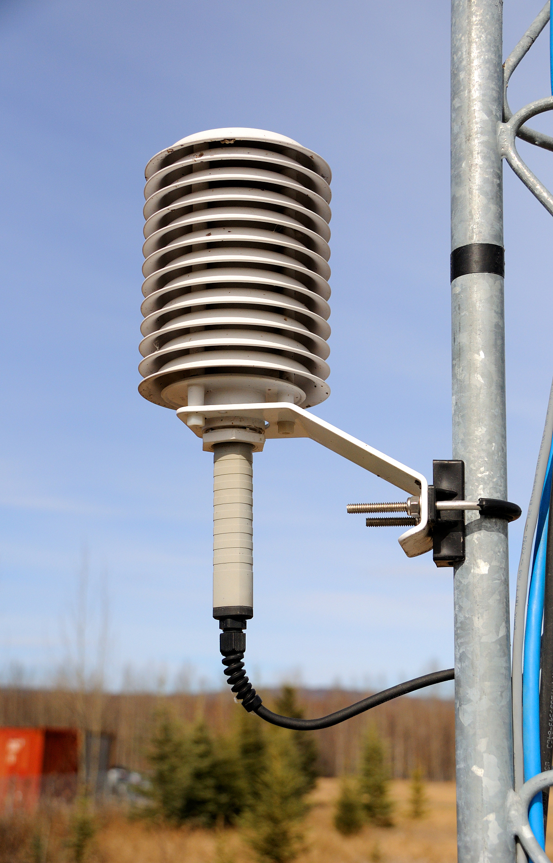
New technology in weather sensors, data analysis, and cloud platforms has changed how cities track and manage weather. Modern weather monitoring systems, like those from Coda Sensor, provide solutions that combine many sensors.
These sensors measure temperature, humidity, wind speed, and air quality in one platform. This enables real-time data visualization, predictive modeling, and automated decision-making. It helps urban planners respond quickly to changing weather conditions.
With IoT (Internet of Things) technologies, cities can gather a lot of weather data. This data comes from sensors placed all over the city. This data can then be processed and analyzed to predict trends, forecast future conditions, and optimize urban management strategies.
Weather monitoring is no longer a luxury—it is an essential part of modern urban planning. Cities can use real-time weather data to make better decisions. This helps them become more resilient and manage resources well. It also protects public health and helps plan for a sustainable future.
As weather becomes more unpredictable because of climate change, urban planners need advanced weather monitoring systems. These systems help keep cities safe, efficient, and adaptable to changing conditions. With companies like Coda Sensor leading the way in innovative weather solutions, cities have the tools they need to tackle the challenges of the future with confidence.
Learn why CO₂ sensors are used in greenhouses an
Learn how smart agriculture sensors improve farm
Learn how multi-parameter water quality sensors
Contact: Molly
Phone: +86-17775769236
Tel: 86-0731-85117089
Email: molly@codasensor.com
Add: Building S5, Aux Square, Yuelu District, Changsha City, Hunan Province, China
We chat

 English